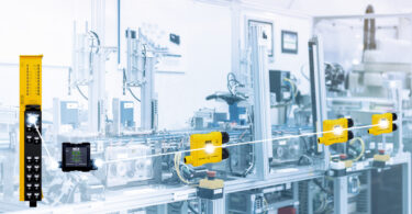
A brief history and overview of LiDAR technology and how it has evolved
For decades, LiDAR technology has been used as an effective means of detection and ranging in various settings and industries. But what exactly is it and where did it come from?
LiDAR is an acronym , standing for LIght Detection And Ranging. It operates on the time of flight concept, which is a very well tested concept in industry. We know the speed of light through our atmosphere so that means we can send a pulse of light, bounce it off a target, and measure the amount of time it takes to come back. By halving the total time and multiplying by the speed of light, we know the distance to the target. This is the core of how LiDAR works.
To capture more data about the surrounding contours, you take the pulse of light and bounce it off a rotating mirror. As the laser rotates around, you get all these measurements in a fan around the LiDAR, which forms a flat plane of measurement. This plane of measurement can be stacked with subsequent planes (like a loaf of sliced bread) to create a three-dimensional map, called a point cloud.
LiDAR technology has a number of advantages, including a high degree of accuracy, high resolution, and a long-detecting distance. This makes it beneficial to use in numerous applications.
First Uses of LiDAR
The concept of LiDAR was first discovered in 1930 to estimate the distance and density of clouds using searchlights, photographic paper, and a telescopic lens. Building upon that concept, the first prototype for LiDAR technology came shortly after the invention of the laser in 1961 from Hughes Aircraft Company. The original intention was to use it to track satellites and also measure clouds and pollution in the air. The technology gained popularity when the United States’ space program used the technology to map the surface of the moon during the 1971 Apollo 15 mission.
Since then, it has been used in numerous applications across a number of industries. NASA continues to use LiDAR for topographic mapping of Earth and to study climate change. Geologists use it to create shoreline maps or make digital elevation models. Archaeologists use it to create high-resolution maps for surveying. It’s even been used in the entertainment industry to create scans of buildings and cities in 3D for production. You may even have LiDAR in your pocket. The latest iPhones have a tiny LiDAR sensor for augmented reality apps.
The first use in industrial applications came from SICK’s own founder, Dr. Erwin Sick, who used light or light-based ranging to make machinery safe. His goal was to find ways to use technology to make people’s jobs safer and make world a better place. Since then, the technology is used in a number of manufacturing and industrial settings, including machine safety and robotics.
Evolution of Data Processing with LiDAR Technology
In the past, much of the data was sent to a controller, which would parse through the information and use that information to take action. This was a complex process and many didn’t have the resources or see the value in undertaking such a project. Over the years, though, we’ve added more tools and functionality to LiDAR to make the technology easier to work with and this has given the ability to obtain highly valuable data from manufacturing processes. Today, many of our LiDAR products come with built-in configuration utilities that make setup simple and intuitive.
Types of LiDAR
Since its invention decades ago, numerous types of LiDAR have been created for various industrial applications. Below are three common types.
Sensorized LiDAR
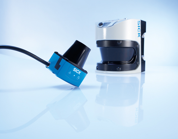
This type of LiDAR comes in the form of a compact and lightweight laser scanner. These are considered entry-level technology as they are typically used for simple area monitoring tasks. Sensorized LiDAR products function well even in high ambient light thanks to the High-Definition Distance Measurement (HDDM) technology from SICK. This reduces cost and complexity in LiDAR detection.
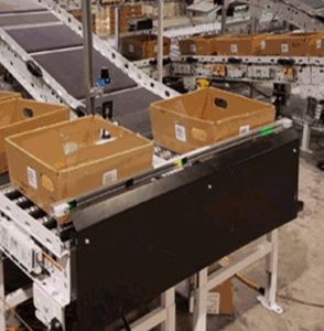
This type of LiDAR is used in some autonomous vehicle applications, but it is also increasingly used for basic applications on the factory floor. The LiDAR sensor creates an invisible plane of detection and can be oriented to detect the presence of objects that should not be there – perhaps an overfilled bin or a tote with objects hanging out of it. This is especially useful in a packaging and production environment.
In bin-picking and pass-through detection applications, sensorized LiDAR can also be used. This allows manufacturers to monitor the production of products and ensure quality control. If an operator reaches into the incorrect bin, the system will signal the operator. Historically, this was often done with multiple light curtains, but a single LiDAR device is much simpler to install and wire.
Multi-Layer LiDAR
 Some people call it 3D LiDAR and others refer to it as multi-layer or multi-channel. This type of LiDAR provides not just a single plane like 2D LiDAR, but three more planes that provide additional detection. This can be used to detect objects at a long distance.
Additional planes add an extra layer of detection that 2D LiDAR lacks. For example, if an object isn’t correctly aligned with the plane, another plane may pick it up instead. This allows more flexibility so that if things aren’t perfectly aligned or 100% always in the exact same position, a multi-layer sensor can adapt to it.
A common reason to use multi-layer LiDAR is to detect pallet overhang in a packaging environment. It can be used to scan pallets to look for any objects that aren’t supposed to be there. It can also ensure that the pallet is in order and that no objects are hanging out that might get caught up on equipment, puncture stretch wrap, or anything that will mess up the line. It can also account for pallets that aren’t completely vertical because it’s multi-layer.
Solid-State LiDAR
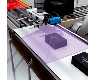 Still another type of LiDAR is solid state. Instead of a single plane or multiple planes like the previous two, this type of LiDAR provides a camera view of everything it looks at. With this technology, a 3D snapshot is taken of the surrounding area that goes beyond just an image. It also provides the depth or distance associated with each “pixel” of that image.
This type of LiDAR can be used in many AMR applications, but also works well in other applications. For example, in bin picking applications, the LiDAR can provide a 3D image of whatever is in the bin, allowing the robot to know when and what it should pick up.
One final application is in package dimensioning for pallet loading. In pallet loading, it’s common to use a robot’s suction gripper to collect several cartons and stack them on a pallet. By adding LiDAR to the end effector, the robot can now determine the position and dimensions of the carton so that it can adapt its grip dynamically to improve efficiency and reduce errors. The camera is quick to install, ready for operation immediately, and provides reliable high-quality 3D data in just one shot.
The Versatility of LiDAR
LiDAR technology can be used in a number of different applications in all different industries. In industrial settings, LiDAR technology has advanced to a point where manufacturers can use this technology in ways we never thought possible. This technology is truly versatile and has changed the world and, we believe, will continue to do so.
![]()
If you’d like to learn more about LiDAR technology, please let us know and we can connect you with one of our LiDAR experts!


